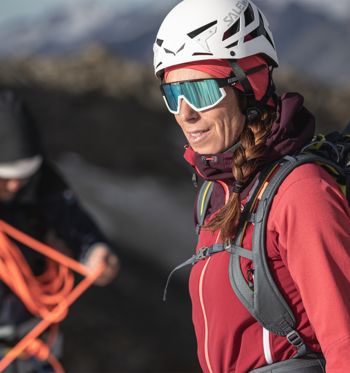
Ice and snow instead of sun, surf and sand – why do we willingly climb to frosty heights in midsummer? Because the wild glacier landscapes guarantee a unique mountain experience, and those ‘high’ summits have something magical about them. For the thrill of crossing a windswept ridge or navigating through a sea of crevasses, we gladly accept the cold and the effort in exchange for the meditative mood at sunrise and the euphoria that hits you when you punch through the clouds to bag your summit.
As a beginner, what are the minimum requirements for your first 4,000-metre peaks?
Glacial landscapes and high peaks promise for an extraordinary mountain experience.
Essentials for a 4,000-metre ascent
Physical fitness is essential for high altitude routes, where you often start before sunrise and only arrive back at the hut in the afternoon. You should have enough strength to reach the summit and for the safe descent and possible incidents. You should be able to manage nine hours of walking and 1,000 metres of ascent at an average altitude. Since your body is under a different type of strain on a mountaineering trek that includes a heavy backpack than cycling and jogging in the lowlands, you train your fitness best on extended mountain hikes or runs.
Surefootedness and a head for heights are necessary for exposed passages on summit ridges or in rocky terrain. On bare hiking trails or via Ferrata, you can adjust to the dizzying views below become more confident on your first 4,000-metre peak. Some mountain schools even offer special courses to overcome a fear of heights.
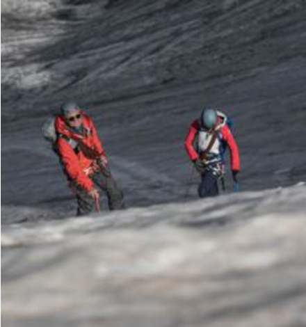
Walking properly on the glacier has to be practiced, …
… that’s why you should take a course if you want to tackle your first 4000m peak safely.
Participation in a course ought to be a crucial requirement for independent high-altitude routes. In addition to stamina, surefootedness and a head for heights, you should also have some experience with the alpine territory. For example, on a four-day course in a small group on the Großvenediger, beginners learn the correct walking technique with crampons and an ice axe, crevasse rescue methods, and touring tactics in a roped team. In addition, the mountain guide imparts a plethora of knowledge regarding the alpine dangers, meteorology, planning and orienteering. Together you will climb simple peaks and gain routine on steeper ground, descending ice and scrambling with crampons attached to your boots.
Before you climb your first 4,000m peak on your own, you should have increased your high altitude experience on 3,000m peaks. Solid knowledge of planning and execution in high alpine terrain is crucial – this includes interpreting the map correctly and not just following a given GPS track.
Acclimatisation in thin air
The right gear for the mountains
In addition to training, experience and acclimatisation, your gear needs to be spot-on. If you book a mountaineering trek, you will receive a detailed equipment list from the mountain school or guide. In addition to warm clothing (e.g. down jacket and hardshell jacket, functional underwear, mittens), the obligatory equipment includes crampons, ice axe, harness, ice screw, carabiners and a rope. With midsummer temperatures in the valley, it is hard to believe that sub-zero temperatures prevail high above. Never underestimate the cold at higher altitudes – especially when it is windy (keyword: wind chill): better to have a pair of warm gloves and a cosy jacket in your rucksack than to risk frostbite.
A first aid kit and a bivy bag are part of your obligatory safety equipment, as is a (fully charged) mobile phone. A sports watch with an altimeter helps with orientation and planning ahead.
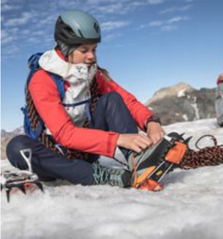
You must be comfortable with your gear, including doning crampons, if you want to move in the alpine safely.
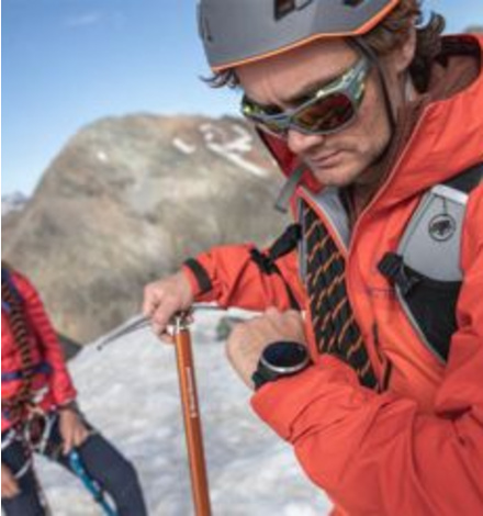
A GPS watch with altimeter helps with staying on track.
After your first few more accessible 4000m peaks, you will quickly set your sights higher – many unforgettable mountain adventures await!
The best 4,000m summits for beginners: 6 climbs for getting you out there!
In the Eastern Alps, only one mountain – Piz Bernina (4,049 m) – rises above the magic 4,000-metre mark. To climb other four-thousand-metre peaks, you have to trek out West. 41 of the 82 four-thousand-metre peaks belong to the Valais Alps. The following tours are suitable for beginners:
1. Breithorn (4.164 m), Wallis, Switzerland
380m elevation, 3:30 hrs. (total) Character: This short ascent is considered one of the most leisurely routes to a 4,000 m summit. The Matterhorn glacier paradise mountain station (3,883 m) on the Klein Matterhorn Route: Matterhorn glacier paradise – Breithorn plateau – Breithorn west summit.
2. Alphubel (4.206 m), Wallis, Switzerland
1,500 m, 9 hrs. (total) Character: This technically not very difficult alpine section with a fantastic panorama requires excellent physical condition and safe walking with crampons on the up to 40° steep summit flank (“Eisnase” on the south-east ridge). Starting/ending point: Täschhütte (2701 m) or Täschalp (2205 m) in the Mattertal Route: Täschhütte – Alphubelsee – Alphubel glacier – Alphubeljoch – Alphubel
3. Allalinhorn (4.027 m), Wallis, Switzerland
800 m up, 560 m down, 5 hrs. (total) Character: With ascent and descent on the most common route, easy, picturesque, and is thus a much climbed four-thousand-metre peak. The traverse with an incline via the Hohlaubgrat and descent via the (easy) regular route does require absolute surefootedness, a head for heights and climbing skills with crampons of difficulty level II (UIAA). Starting point: Saas-Fee (1,798 m) or Metro Alpin middle station (Stollenfenster, 3,200 m) End point: Mittelallalin station (3,456 m) Route: Middle station (Stollenfenster) Metro Alpin – Hohlaubgletscher – Hohlaubgrat – Allalinhorn – Feejoch – Mittelallalin station
4. Lagginhorn (4.010 m), Wallis, Switzerland
1,060m elevation, 6:30 hrs. (total) Character: Almost glacier-free alpine terrain over rocky, partly exposed terrain, with easy climbing in difficulty level II (UIAA). The danger of falling rocks (take a helmet). Starting/ending point: Saas Grund (1,559 m) or Hohsaas railway station (3,142 m) Route: Hohsaas – Lagginhorn glacier – West ridge – Lagginhorn
5. Gran Paradiso (4.061 m), Aostatal, Italy
1,400m elevation, 8 hrs. (total) Character: Easy, heavily frequented mountaineering route that requires endurance, a head for heights and some climbing ability – on the last 100 metres from the ridge to the summit, very exposed, easy rock climbing (UIAA II+). Starting/ending point: Alpe Pravieux car park (1,830 m) or Rifugio Chabod (2,750 m) in Valsavarenche Route: Rifugio Chabod – Laveciau glacier – Gran Paradiso
6. Spaghetti Traverse
In good conditions, mountaineers can climb eleven technically easy four-thousand-metre peaks in five days on this trail through the impressive Monte Rosa massif. Character: A high level of fitness is required (total altitude difference approx. 5,000 metres, daily walking time up to 10 hours), a good head for heights and surefootedness, and glacier experience on easy to moderately tricky touring (climbing passages). Starting and finishing point: Zermatt Route / Stages:
- Day 1: Zermatt – Breithorn (4.164 m) – Pollux (4.091 m) – Rifugio Guide d´Ayas (3.400 m)
- Day 2: Rifugio Guide d´Ayas – Castor (4.226 m) – Rifugio Quintino Sella (3.585 m)
- Day 3: Rifugio Quintino Sella – Il Naso (4.205 m) – Balmenhorn (4.167 m) – Vincent-Pyramide (4.215 m) – Rifugio Città di Mantova (3.400 m)
- day 4: Rifugio Città di Mantova – Corno Nero (4.215 m) – Ludwigshöhe (4.341 m) – Parrotspitze (4.436 m) – Signalkuppe / Capanna Regina Margherita (4.456 m)
- Day 5: Capanna Regina Margherita – Zumsteinspitze (4.563 m) – Monte-Rosa-Hütte – Station Rotenboden (2.815 m) – Zermatt
